
 Sheets wrapped around kiawe logs, an attempt to catch topsoil being blown away by the strong winds t...") Kahoʻolawe, 2017
Kahoʻolawe, 2017
1754 hits
Sheets wrapped around kiawe logs, an attempt to catch topsoil being blown away by the strong winds that sweep the upland.") 17-9 ErodedGully
17-9 ErodedGully
1437 hits Several 500-ton blasts of TNT made this crater in 1965. It was an attempt by the US Navy to mimic th...") Kahoʻolawe, 2017
Kahoʻolawe, 2017
1871 hits
Several 500-ton blasts of TNT made this crater in 1965. It was an attempt by the US Navy to mimic the effects of a nuclear blast and to study its efffects on ships moored nearby. Water in the crater used to be brackish but is now entirely saline This dirt track allows access to sections of the hard pan being replanted with native vegetation. It...") Kahoʻolawe, 2017
Kahoʻolawe, 2017
1804 hits
This dirt track allows access to sections of the hard pan being replanted with native vegetation. It lies just above Hakioawa Bay. Between the posts, ground has been cleared for UXO down to a depth of four feet.") 17-9 Luku3
17-9 Luku3
1326 hits This ancient wiliwili tree is a remnant of the vast dryland native forest that once covered the isla...") 17-9 Wiliwili
17-9 Wiliwili
1416 hits
This ancient wiliwili tree is a remnant of the vast dryland native forest that once covered the island. It lies along the road near the summit of the island. The pōhaku in the distance lies in an enclosure above the UH faculty apartments on Dole St. in Hono...") Pōhaku and homeless camp at Wa’ahila, 2010
Pōhaku and homeless camp at Wa’ahila, 2010
917 hits
The pōhaku in the distance lies in an enclosure above the UH faculty apartments on Dole St. in Honolulu. A homeless lady has set up camp inside the enclosure. Cultural experts from a large Native Hawaiian organization have determined that the site is a heiau. Objects brought to the base of the pōhaku by the homeless lady who has set up camp within the enclo...") Pōhaku at Waʻahila, 2013
Pōhaku at Waʻahila, 2013
944 hits
Objects brought to the base of the pōhaku by the homeless lady who has set up camp within the enclosure. Cultural experts from a large Native Hawaiian organization have determined that the site is a heiau. An important pōhaku (stone) stood on this spot until 1977, when it was destroyed by the US Army in ...") Imu Ahi at Puowaina, 2015
Imu Ahi at Puowaina, 2015
750 hits
An important pōhaku (stone) stood on this spot until 1977, when it was destroyed by the US Army in a renovation of the viewing area at Puowaina (Punchbowl). It is possible that the pōhaku was merely buried and still lies under the dirt at this spot. Waianaʻe residents with ancestral connections to that area use the term Unu rather than heiau to re...") Kamaile Unu, 1996
Kamaile Unu, 1996
1411 hits
Waianaʻe residents with ancestral connections to that area use the term Unu rather than heiau to refer to large ceremonial structures. A heiau within a resort complex in Kahaluʻu.") Iniʻikawai Heiau, 2004
Iniʻikawai Heiau, 2004
2131 hits
A heiau within a resort complex in Kahaluʻu. This is not the original location of Ahuena, which stood nearby in what is now an adjacent private r...") Ahuena Heiau, 2006
Ahuena Heiau, 2006
1385 hits
This is not the original location of Ahuena, which stood nearby in what is now an adjacent private residence. Cultural practitioner David Roy was instrumental in having the stones of the heiau moved to where they stand now. Before the reconstruction of Hapaialiʻi and the demolishing of the Outrigger Hotel.") Hapaialiʻi, 2007
Hapaialiʻi, 2007
2611 hits
Before the reconstruction of Hapaialiʻi and the demolishing of the Outrigger Hotel. Makoleʻa Heiau has been reconstructed by the landowner, and its surrounding complex turned into a c...") Makoleʻa, 2008
Makoleʻa, 2008
1749 hits
Makoleʻa Heiau has been reconstructed by the landowner, and its surrounding complex turned into a cultural preserve. The heiau is connected to the aliʻi wahine Makoleʻa. This significant pōhaku used to lie near the road but was moved uphill to the residence of Nowlin C...") Kini, 2016
Kini, 2016
817 hits
This significant pōhaku used to lie near the road but was moved uphill to the residence of Nowlin Correia. Unfortunately, after Correiaʻs passing, the landowner (DHHL) evicted his family and the house now sits vacant, occupied by squatters. In the distance is Kealakekua Bay") Location of the battle of Moku Ohai
Location of the battle of Moku Ohai
1127 hits
In the distance is Kealakekua Bay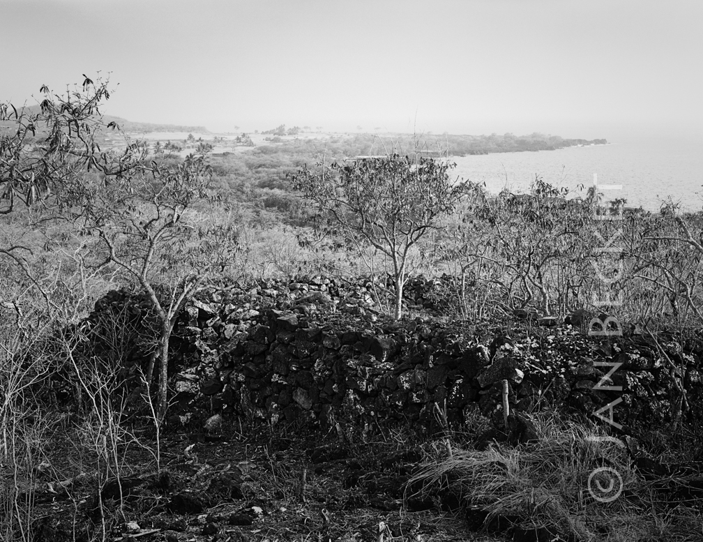 Ukanipō Heiau, 2009
1119 hits
The principal structure at Ukanipō, a complex of many other features covering a large area. Ukanipō is also the name of a heiau in Mākua Valley on Oʻahu. A large platform heiau adjacent to the pā of Kalaniopuʻu.") Hōkūliʻa 16758, 2007
Hōkūliʻa 16758, 2007
917 hits
A large platform heiau adjacent to the pā of Kalaniopuʻu. A platform heiau a mile inland, walled on three sides and open to the ocean on the fourth.") Hōkūliʻa 16511, 2007
Hōkūliʻa 16511, 2007
921 hits
A platform heiau a mile inland, walled on three sides and open to the ocean on the fourth.") Hōkūliʻa 10278, 2008
Hōkūliʻa 10278, 2008
912 hits") Hōkūliʻa Halekiʻi, 2009
Hōkūliʻa Halekiʻi, 2009
864 hits") Hōkūliʻa Halekiʻi, 2009
Hōkūliʻa Halekiʻi, 2009
885 hits The pā (house enclosure) of the aliʻi nui Kalaniopuʻu.") Hōkūliʻa 16756, 2009
Hōkūliʻa 16756, 2009
842 hits
The pā (house enclosure) of the aliʻi nui Kalaniopuʻu. A wall near the pā of Kalaniopuʻu") Hōkūliʻa 16754, 2009
Hōkūliʻa 16754, 2009
877 hits
A wall near the pā of Kalaniopuʻu Old Government Road, built in the 19th century, runs straight through a large platform heiau.") Hōkūliʻa 16384, 2010
Hōkūliʻa 16384, 2010
864 hits
Old Government Road, built in the 19th century, runs straight through a large platform heiau. Near the pā of Kalaniopuʻu") Hōkūliʻa 16756, 2010
Hōkūliʻa 16756, 2010
835 hits
Near the pā of Kalaniopuʻu The stepped structure at the entrance to the cave. Note the kiʻi pōhaku (petroglyphs) on the left ...") Hōkūliʻa Halekiʻi, 2018
Hōkūliʻa Halekiʻi, 2018
938 hits
The stepped structure at the entrance to the cave. Note the kiʻi pōhaku (petroglyphs) on the left rock face. Near the pā of Kalaniopuʻu") Hōkūliʻa 16756, 2018
Hōkūliʻa 16756, 2018
906 hits
Near the pā of Kalaniopuʻu Near the pā (house enclosure) of Kalaniopuʻu, Aliʻi Nui at the time of Cookʻs visit.") Hōkūliʻa 16756, 2018
Hōkūliʻa 16756, 2018
947 hits
Near the pā (house enclosure) of Kalaniopuʻu, Aliʻi Nui at the time of Cookʻs visit. A small platform at the shore near the pā of Kalaniopuʻu") Hōkūliʻa 16758, 2018
Hōkūliʻa 16758, 2018
974 hits
A small platform at the shore near the pā of Kalaniopuʻu The residence of Lonoikamakahiki is truncated by the tennis court at the Keauhou Surf and Racket Clu...") Paniau, 2006
Paniau, 2006
1073 hits
The residence of Lonoikamakahiki is truncated by the tennis court at the Keauhou Surf and Racket Club The road was built in the 19th century, probably by prison labor. Public access along the road is st...") Old government road
Old government road
1031 hits
The road was built in the 19th century, probably by prison labor. Public access along the road is still protected by law. Possibly a house platform") Kakapa Bay, 2018
Kakapa Bay, 2018
1043 hits
Possibly a house platform A possible ceremonial platform adjacent to the ocean.") Kakapa Bay, 2018
Kakapa Bay, 2018
1002 hits
A possible ceremonial platform adjacent to the ocean. The large structure adjacent to the fishtrap at ʻAiʻōpio. Signs at this heiau mistakenly identifi...") Puʻuoina Heiau, 2018
Puʻuoina Heiau, 2018
1056 hits
The large structure adjacent to the fishtrap at ʻAiʻōpio. Signs at this heiau mistakenly identified it several years ago as Halemanō Heiau, which may lie under water outside of the entrance to Honokōhau Harbor. Hale Aʻama Heiau at the Keolanhihi complex, according to the Kekahuma map, which identifies it as a...") Haleaʻama Heiau, 2018
Haleaʻama Heiau, 2018
1084 hits
Hale Aʻama Heiau at the Keolanhihi complex, according to the Kekahuma map, which identifies it as a surfing heiau. Nobody now surfs in that area; it is possible that wave patterns have shifted. Or perhaps its connection with surfing is ceremonial and indirect. Along Aliʻi Rd.") Laʻaloa Heiau, 2018
Laʻaloa Heiau, 2018
1041 hits
Along Aliʻi Rd.") Kuʻemanu Heiau, 2018
Kuʻemanu Heiau, 2018
1066 hits") Holualoa, 2018
Holualoa, 2018
1046 hits This image was made from the top of the holua. The end closest to the highway is overgrown.") Holualoa, 2018
Holualoa, 2018
996 hits
This image was made from the top of the holua. The end closest to the highway is overgrown. A large structure near Lekeke, possibly a heiau.") Lekeke, 2018
Lekeke, 2018
1077 hits
A large structure near Lekeke, possibly a heiau. The residence of Lonoikamakahiki at Paniau, according to the Kekahuna map. Now, the location of the ...") Paniau, 2018
Paniau, 2018
1056 hits
The residence of Lonoikamakahiki at Paniau, according to the Kekahuna map. Now, the location of the Keauhou Surf and Racket Club. A large structure at Kua Bay, possibly a fishing heiau") Kua Bay Heiau, 2005
Kua Bay Heiau, 2005
1198 hits
A large structure at Kua Bay, possibly a fishing heiau") Ahuaumi, 2004
Ahuaumi, 2004
1112 hits") Kapuanoni, 2009
Kapuanoni, 2009
1199 hits A platform in a petroglyph field at the Kona - Kohala border, along the Old Government Road") Ahu o Lono, 2018
Ahu o Lono, 2018
1037 hits
A platform in a petroglyph field at the Kona - Kohala border, along the Old Government Road Both heiau have been reconstructed") Keʻekū Heiau and Hāpaialiʻi Heiau, 2018
Keʻekū Heiau and Hāpaialiʻi Heiau, 2018
949 hits
Both heiau have been reconstructed An upright stone in the surf, said to be a boundary marker.") Kaloko, 2009
Kaloko, 2009
1131 hits
An upright stone in the surf, said to be a boundary marker.") Kukuipahu, 2018
Kukuipahu, 2018
1009 hits A two-tiered structure in excellent condition.") Kapaʻa, 2018
Kapaʻa, 2018
1120 hits
A two-tiered structure in excellent condition.